The Wild Days guide
Limpert Bay is a wide bank of rounded grey-blue pebbles and rock ledges just west of the River Thaw, beside the site of the old Aberthaw power station. It is where the Glamorgan Heritage Coast begins, and the free car park at Gileston makes it an easy start for the cliff walk west.
Why it’s worth the trip
Not the prettiest bay on this coast, but one of the most interesting. Over the bank of stones the shore opens out into pale lias pebbles and, at low tide, flat rock terraces with patches of sand and mud. Wartime anti-tank cubes and pillboxes line the back of the beach, and more than a thousand species have been recorded here, 62 of them of special conservation concern in Wales.
Make a wild day of it
Low tide on the ledges
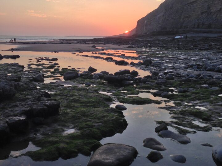
Come on a falling tide and cross the pebbles to the rock terraces, where pools, sand and mud appear as the water drops. Waders feed along the edge, and the bank of stones has its own shingle plants. Turn back in good time: the tide comes in fast over flat rock.
Breaksea Point
A few minutes south along the sea wall, Breaksea Point is one of two places with a claim to be the southernmost tip of mainland Wales. Its rival, Rhoose Point, is 4.4 km east. The sea wall here dates from 1958 and holds Breaksea in place, while Rhoose is slowly being worn back by the waves.
West along the Heritage Coast
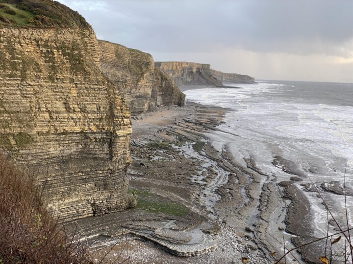
The coast path heads west over field edges to Penry Bay and Summerhouse Point, where an 18th-century summer house stands inside an Iron Age fort. Beyond, the blue lias cliffs rise, with curving rock ridges and long pools below at Stout Bay. Llantwit Major beach, with a cafe and toilets, is about 6.5 km away.
The power station
Barry Golf Club lost its course on the Leys when the first power station was built in the late 1950s. The coal-fired station has closed and is being demolished, with work due to finish by spring 2027, so expect changes and diversions.
Tides and safety
The tide returns fast over the flat terraces, so keep an eye on it when you are out on the rocks. West of here, Stout Point can only be rounded on the beach for a couple of hours around low tide: stay on the clifftop. The cliffs grow higher beyond Summerhouse Point and drop stones on the beach below, so keep away from their foot. Keep clear of the old power station water intakes in the bay. There are no lifeguards and the bay is not a designated bathing water. In an emergency call 999 and ask for the Coastguard.
When to go
A falling tide for the ledges, spring and autumn for wildlife, and a calm evening for the light over the Channel to Somerset.
Good to know
- Parking: free car park for about 30 cars at the end of the lane south of Gileston.
- Toilets and food: none at the bay; the nearest are at Llantwit Major beach.
- Dogs: the council lists Aberthaw beach (the Leys) as dog-friendly in summer.
- Bus: the 304 stops in St Athan, about 2 km away.