The Wild Days guide
Summerleaze is Bude’s town beach, a wide spread of golden sand where the River Neet and the old Bude Canal meet the sea. Tucked into the rocks at its northern end is the Sea Pool, a tidal swimming pool the sea refills on every tide.
Why it’s worth the trip
It is a proper all-day beach, usable at any state of the tide, with lifeguards in season, a big car park right behind it and the town a few minutes away. It is also where two very different walks begin: the coast path north over the cliffs, and the canal towpath inland.
Make a wild day of it
The Sea Pool
Built in the 1930s, with the Thynne family putting up half the money, the pool is about 88 m by 43 m, partly natural and partly walled. It is free, open all year and looked after by a volunteer charity, the Friends of Bude Sea Pool, so a donation helps. On a day when the open sea is too rough it is the best swim in town.
North along the coast path
Climb past the pool on to Summerleaze Down and follow the South West Coast Path past Crooklets and the low cliffs of Maer to Northcott Mouth, about 2.3 km, where the wreck of the SS Belem shows at low tide. It is easy going with no stiles.
The Bude Canal
The canal opened in 1823 to carry the shell-rich sand from this beach inland as fertiliser. Its 35 miles used inclined planes to haul wheeled tub boats up into the hills, but the first stretch from the sea lock was a broad canal for barges. Walk its towpath past Bude Marshes, where herons and egrets fish, to Helebridge Basin, about 3.5 km of level, peaceful walking each way.
The rocks
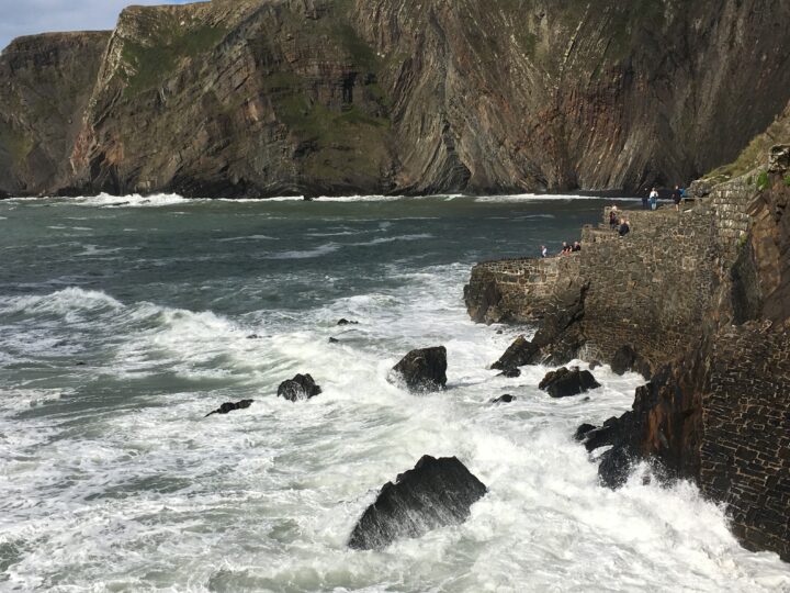
Bude’s cliffs are the only ones in Cornwall made of Carboniferous sandstone, folded and faulted into zigzags you can see from the coast path. After big winter storms the sand sometimes drops enough to show the rails of the old tramway that carried sand off the beach.
Tides and safety
RNLI lifeguards patrol from 10am to 6pm: in 2026 over Easter, daily from 2 May to 27 September, then at weekends in October and over half-term. Swim and bodyboard between the red and yellow flags, and stay well away from the canal sea lock, where the current is strong. At low tide you can walk to Crooklets on the sand, but the rocks between can cut you off as the tide rises. Check a Bude tide table, and in an emergency call 999 and ask for the Coastguard.
When to go
June and September give warm water, lifeguards and fewer people than August. Come at low tide for the widest beach and the walk north. In winter the beach is empty and the Sea Pool is still open for the brave.
Good to know
- Parking: Summerleaze council car park, 421 spaces right behind the beach. Summer 2026: £2.70 for an hour to £11.70 for 24 hours; winter from £1.50. Pay by card or app.
- Toilets: free public toilets by the beach.
- Food: cafes, pubs and shops in Bude, a few minutes’ walk.
- Dogs: allowed, but on a lead from 10am to 6pm between 21 May and 30 September.
- Buses: Go Cornwall 95 from Boscastle, Tintagel and Wadebridge, and Stagecoach 6 from Okehampton.