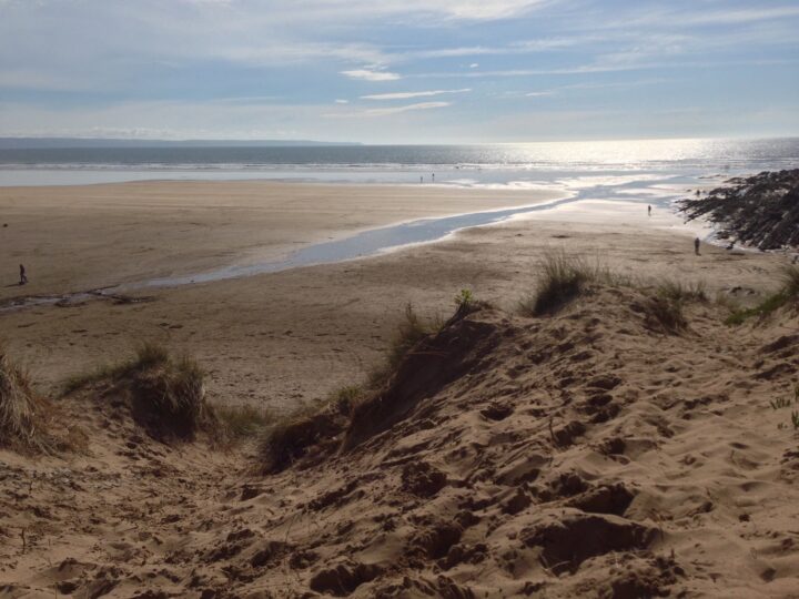
This is not a beach. Basett’s Ridge is a sandbank in the middle of the River Taw, off Fremington Quay, that shows at low tide and disappears at high water. You cannot safely reach it, but you can watch it from the quay.
Why it’s worth the trip
At low water the Taw turns into a wide spread of sand and mud with named ridges in the middle: Basett’s Ridge here, with Chivenor Ridge and Penhill Ridge close by. From Fremington Quay you look across them to Heanton, the airfield at Chivenor and the dunes of Braunton Burrows.
Make a wild day of it
The old quay has a cafe in its station building and a small heritage centre with a viewing tower. Walk the short loop up Fremington Pill, where little egrets feed, or follow the flat Tarka Trail west to the sands at Instow or east into Barnstaple.
Tides and safety
The Taw has a big tidal range and fast currents, and the channels between the banks fill long before the banks cover. The shore is soft mud. Do not walk out on to the sands and do not swim. In an emergency call 999 and ask for the Coastguard.
When to go
Low tide to see the ridges; the last hour or two of the rising tide for birds pushed close to the shore.
Good to know
Parking: small car park at Fremington Quay.
Food: Fremington Quay Cafe; pubs in Fremington.
Bus: the 21 and 21A stop in Fremington village, about 1 km away.
Getting there and parking
1
Fremington Quay car park
Check the board on site
Small car park beside the cafe and heritage centre at the old quay, on the Tarka Trail.
The walk in. Watch from Fremington Quay on the Tarka Trail. Do not walk out on the sands or mud.
By bus. Stagecoach South West buses 21 and 21A run daily between Barnstaple, Fremington, Instow and Bideford; the quay is about 1 km from the village stops. Check times before you travel.
Traced on the paths with Ghrups trail data. Dashed: along the beach or over open ground.
Fremington Quay, Fremington Pill and Penhill loop
Easy
2.4 mi (3.8 km)1h45 m upcircular
Start: Fremington Quay
A short loop of creek, village and farmland from the old quay. From Fremington Quay, where the cafe and heritage centre look out over Basett's Ridge and the Taw, walk west along the Tarka Trail to the bridge over Fremington Pill. Turn off on to the footpath that follows the creek south, a lovely stretch when the tide is in, with little egrets often fishing, and come into Fremington village by the green. Head east on Mill Hill and the lanes and paths beyond, then north past Penhill and back along the field path to the quay. Expect lanes, field edges and green lanes that can be muddy after rain. Keep dogs on a lead through farmland and on the lanes. About 4 km, and easy going.
3 mtop 30 m
Path 92%
Paved 5%
Open ground 3%
1h05 at a steady pace (49 min brisk, 1h26 relaxed)
Steep in places
Trail data by Ghrups
Routes are traced from open map data. Check the tide times before you set off, and carry a proper map.