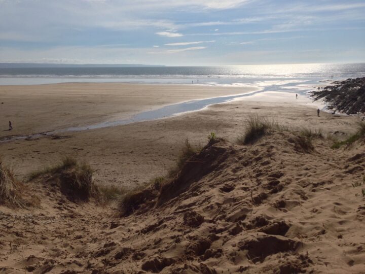
This is not a beach. South Tail is the drying sandbank at the southern end of the Bideford Bar, off the tip of Northam Burrows where the Taw and Torridge meet the sea. Please do not walk out to it: enjoy it from the shore.
Why it’s worth the trip
From Grey Sand Hill, at the northern tip of the Burrows, you look over a shifting maze of sand that comes and goes with the tide, with the bar breaking white beyond it and Braunton Burrows across the water.
The Bideford Bar runs across the river mouth between two tails of sand: South Tail on this side and North Tail off the Braunton shore. Leading lights have guided ships over it since 1820, and it has still claimed many.
Make a wild day of it
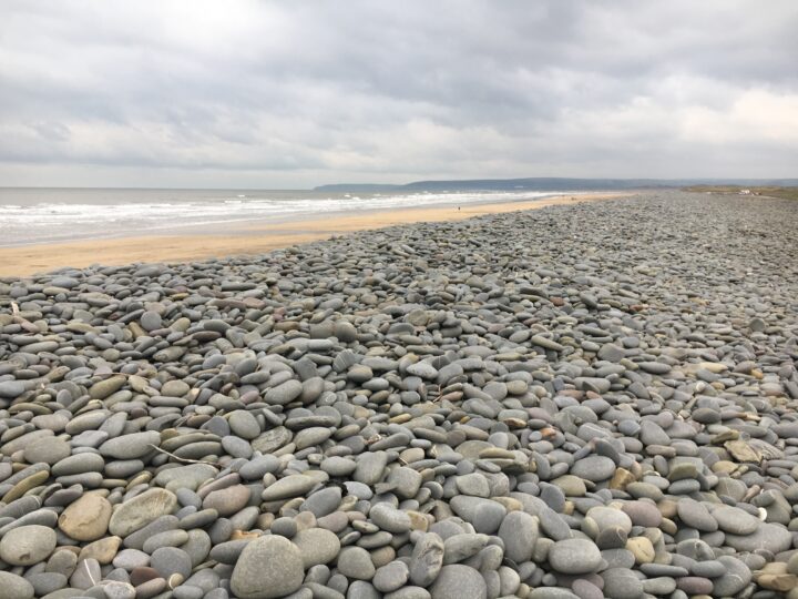
Walk up from the Burrows Centre on the coast path behind the pebble ridge, then carry on round the Skern saltmarsh for wading birds, or spend the afternoon on the long sands of Westward Ho!.
Tides and safety
The whole estuary empties over the Bideford Bar here, one of the most dangerous river mouths in the country. The tide floods in behind the banks fast, the channels shift and there are soft muddy patches. Never walk or swim out to South Tail. In an emergency call 999 and ask for the Coastguard.
When to go
Low tide on a clear day to see the banks; high water in a westerly swell to watch the bar break, from a safe distance.
Good to know
Parking: on Northam Burrows (seasonal toll, 3 April to 1 November).
Toilets and cafe: at the Burrows Centre.
Swimming: no. Swim at Westward Ho! between the lifeguard flags in summer.
Getting there and parking
1
Northam Burrows Country Park (Sandymere and Burrows Centre)
EX39 1XSTorridge District CouncilSeasonal toll, 3 April to 1 November: £8 a day per car, £4 evening or motorcycle. Free November to March.
Car parking on the common by Sandymere and the Burrows Centre, which has toilets and a cafe.
The walk in. View from Grey Sand Hill, about 1.5 km north of the Burrows Centre on the coast path. Do not go out on to the sand.
By bus. Stagecoach South West bus 21 runs daily from Barnstaple and Bideford to Northam; the Sandymere Road/Jackets Lane stop is about 1.5 km from the Burrows Centre. Check times before you travel.
Traced on the paths with Ghrups trail data. Dashed: along the beach or over open ground.
Burrows Centre to Grey Sand Hill
Easy
2.1 mi (3.4 km)1h38 m upout and back
Start: The Burrows Centre, Northam Burrows
A short, flat walk to the best safe viewpoint over the estuary mouth. From the Burrows Centre follow the South West Coast Path north past Sandymere, behind the dunes and along the back of the great pebble ridge, with the sea on your left and the open common on your right. At Grey Sand Hill, the tip of Northam Burrows, stop and look out over the shifting sands of the Bideford Bar, South Tail among them, and across to Braunton Burrows and Crow Point. Stay on the shore: the tide floods in fast behind the banks. Return the same way, or carry on round the Skern saltmarsh on the park's Red Trail, which brings you back to the centre after about 5 km in all. Sheep and horses graze the common, so keep dogs under control.
6 mtop 11 m
Path 99%
Steps 1%
57 min at a steady pace (42 min brisk, 1h15 relaxed)
Gentle
2 flights of steps
Through North Devon Coast National Landscape, Sand Dunes
Trail data by Ghrups
Routes are traced from open map data. Check the tide times before you set off, and carry a proper map.